
Long Beach Home on Verge of Collapse as Tropical Storm Rachel Pounds the Peninsula
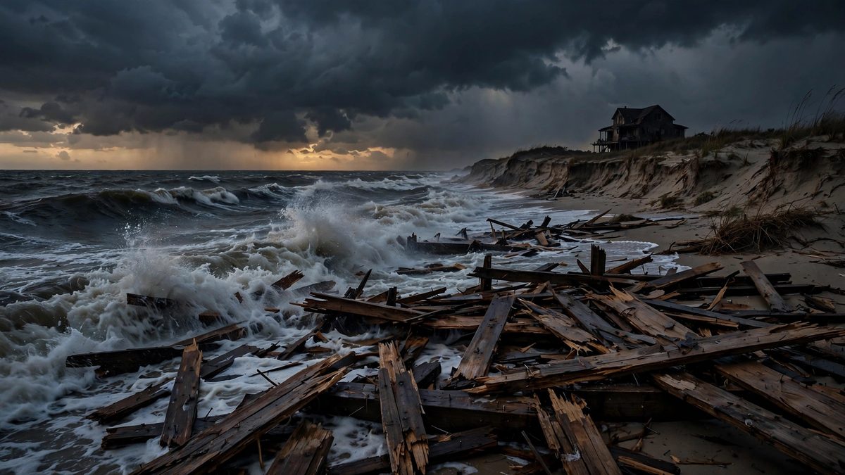
Waves from former Hurricane Rachel tore apart sections of the Long Beach Peninsula boardwalk at Friday's high tide, leaving one beachfront home on the verge of collapse. The city red-tagged two structures and yellow-tagged three more, and the NWS has a coastal flood advisory in effect through Tuesday as worse conditions are expected this weekend.
Key points
- *Updated 14:30 UTC: Developing story.*
- Rachel has come inland, and the danger has shifted from the coast to the desert.
- The storm's remnants moved over Southern California early Sunday morning as a post-tropical system, and heavy rain and wind are now spreading across the Desert Southwest.
*Updated 14:30 UTC: Developing story.*
Rachel has come inland, and the danger has shifted from the coast to the desert.
The storm's remnants moved over Southern California early Sunday morning as a post-tropical system, and heavy rain and wind are now spreading across the Desert Southwest. The Weather Prediction Center has issued a Level 3 of 4 flood threat for Sunday covering southern Nevada, including Las Vegas, southwest Utah and northwest Arizona, where numerous flash flood events are expected with significant impacts possible.
Widespread rain totals of 1 to 5 inches are expected, with locally higher amounts possible, and the rain could linger into Monday or Tuesday. Forecasters warn of flash flooding in normally dry creeks, arroyos, slot canyons and urban areas across Southern California, San Diego, Las Vegas and Salt Lake City.
San Diego and Las Vegas could each see an inch or more of rain. That is about double what San Diego usually gets in all of October, and triple the Las Vegas monthly average. Desert ground cannot absorb such intense bursts quickly, which is why forecasters are urging extra caution. The center has outlined a Moderate Risk of excessive rainfall from parts of Southern California into southern Nevada, northwest Arizona and southwest Utah.
Holiday weekend visitors to national parks face elevated risk: Grand Canyon, Zion, Death Valley and Arches could all see flooding rain. The Weather Company advised anyone with park plans in the región to cancel them until Wednesday.
San Diego spent Saturday under a tropical storm watch, only the second on record for the city. The first came with Hurricane Hilary in 2023, the first year such watches were issued for the región. Wind gusts of 45 to 65 mph are expected inland across the Desert Southwest on Sunday, in Arizona, southern Nevada and Utah. Around San Diego, gusts could reach 25 to 40 mph in lower elevations and 50 to 70 mph in the mountains.
Where Rachel's tropical moisture meets a cold front arriving from the Northwest, snow is falling in the northern Rockies. Parts of Wyoming, Montana and Idaho could see their first significant snow of the season, with some spots forecast to get more than a foot. The same collision brings long-awaited heat relief: temperatures across much of the región will drop 5 to 15 degrees below average by Monday, with highs in the upper 60s and 70s for Southern California.
As a tropical storm, Rachel packed sustained winds near 60 mph late Saturday as it accelerated toward northern Baja California. No new injuries have been reported. This is a developing story and will be updated as new information is verified.
LONG BEACH, Calif.: Powerful waves from former Hurricane Rachel tore apart sections of the Long Beach Peninsula boardwalk Friday morning, leaving one beachfront home on the verge of collapsing into the ocean as a new storm pounded a coastline already worn down by a brutal season.
The damage was laid bare at high tide, which arrived shortly after 9 a.m. KTLA's helicopter cameras captured chunks of the shattered boardwalk floating out to sea while floodwaters swamped nearby streets and patios, and relentless erosion kept chewing at the ground beneath waterfront homes.
"This is easily the most damage I have seen over the past couple of weeks," KTLA's Rich Prickett reported from the air. "Now the entire boardwalk is just starting to shred away, and now some of these homes are being impacted even more severely."
City tags damaged buildings
By Friday afternoon, city building crews were assessing structures along the Alamitos Peninsula and had red-tagged two buildings and yellow-tagged three more, city spokesman Laath Martin told City News Service. A red tag means a structure is unsafe to enter; a yellow tag lets owners step inside briefly to retrieve belongings but bans anyone from staying until the building is declared structurally safe.
"Building crews are currently assessing damage and impacts seen from wave activity this morning," Martin said, adding that the city would release updates once the assessments are complete.
FOX 11 LA reported that inspectors issued preliminary red tags for two structures and a yellow tag for another along the 6400 and 6500 blocks of Seaside Walk, damage that, combined with a structure already yellow-tagged during Hurricane Marie, puts four buildings in the damaged column.
City officials also reported significant damage to roughly 30 feet of the Peninsula bulkhead between 65th and 66th Place, where persistent waves tore through existing lumber. Crews worked during low tide to repair the structure and stacked about 1,000 sandbags to shore it up.
A coast already worn down
Rachel is only the latest blow. Beachfront residents are still cleaning up from the pounding they took from Hurricane Marie over Labor Day weekend, which flooded homes, destroyed cars and smashed the boardwalk from 62nd Place to 67th Place, followed by another storm round from Hurricane Polo. After Marie, Long Beach declared a local emergency.
For this storm, the city said it distributed 7,600 sandbags to residents in the area, bringing the total handed out across three recent storms to about 15,000, with additional sandbag sites open at fire stations across Long Beach.
Worse may be ahead
The National Weather Service has issued a coastal flood advisory through 2 p.m. Tuesday, Oct. 13, warning that powerful swells from Rachel, downgraded from a Category 1 hurricane early Thursday, are combining with unusually high tides, raising the risk of seawater flooding beaches, walkways and low-lying roads. Officials say the greatest risks are expected around Sunday, and the threat could intensify Sunday night into Monday as stronger swells and high tides combine.
No injuries had been reported as of publication. This is a developing story and will be updated as new information is verified.
Watch
Timeline
- Oct 9, 2026Tropical Storm Rachel, downgraded from a Category 1 hurricane Thursday, sends powerful swells into the Long Beach Peninsula. At the high tide shortly after 9 a.m., sections of the boardwalk are torn apart and one beachfront home is left on the verge of collapse.
- Oct 9, 2026City crews red-tag two structures and yellow-tag three along the Alamitos Peninsula; FOX 11 reports two red tags and one yellow tag along Seaside Walk plus a previously yellow-tagged building from Hurricane Marie. The NWS issues a coastal flood advisory through 2 p.m. Tuesday, Oct. 13.
- Oct 11, 2026Rachel's post-tropical remnants move inland over Southern California early Sunday; the Weather Prediction Center issues a Level 3 of 4 flood threat for southern Nevada, southwest Utah and northwest Arizona with 1 to 5 inches of rain forecast, while San Diego sits under only its second-ever tropical storm watch.
Sources
- FOX 11 LA: Long Beach coastal flooding: Tropical Storm Rachel damages homes, seawall
- NY Post: Beachfront home on brink of collapse as tropical storm batters Southern California
- MyNewsLA: High Surf Pounds Long Beach Peninsula Again, With Worst to Come
- CNN: Post-tropical storm lashing southwest with coastal flooding, heavy rain and strong winds
- Weather.com: Rachel brings flood, wind, waves for Southern California
- The Watchers: Tropical Storm Rachel brings flash-flood threat to Southern California and U.S. Southwest